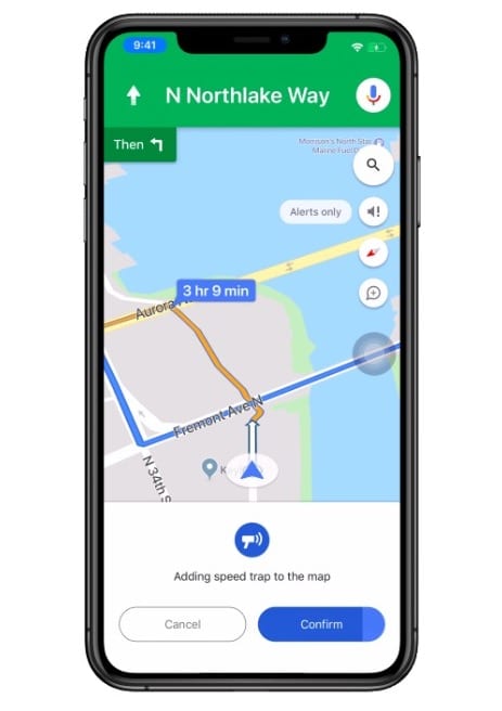
Are you one of the drivers out there who sticks to Waze for navigation purposes because it lets you know other useful info, such as where police cars are hiding in wait to give you a speeding ticket? Well, you can soon switch to Google Maps and enjoy the same perks.
Google Maps is finally adding this feature to its own navigation system. Users will be able to report speed traps, crashes, road closures, construction, slowdowns, disabled vehicles and objects on the road. Some of those updates are already available on Android devices, but they’re now being rolled out globally to Apple users as well.
Photo Credit: iStock
“This feature has been one of our most popular on Android, and we’re excited to expand it to iOS,” Google Product Manager Sandra Tseng wrote in a recent blog post.
“Google Maps has always helped people get from point A to B in the easiest way possible. Today, we’re adding more tools that reflect real-time contributions from the community so you can stay even more informed when you’re behind the wheel.”
Photo Credit: Google
Submitting a report through Google Maps is simple and streamlined. You simply tap on the + sign and then click “Add a report.”
Unlike on Waze, there’s no option to add comments or photos to your report, so there’s less detail available — but also less clutter.
This is exactly the sort of thing I like in an update. It’s easy, it’s useful, and it makes me actually want to bother to go through with downloading new software.
The post Google Maps Is Adding Alerts for Speed Traps and Other Road Incidents appeared first on UberFacts.

