10 Interesting Facts About Music History

I’ve been into music since I was a little kid and I feel like I grew up on the good stuff. From my parents, it was mostly oldies: the Beach Boys, the Beatles, the Everly Brothers, Sam Cooke.

And then my older brother got me into punk and metal: the Ramones, Black Sabbath, AC/DC, and all other kinds of bands that warped my young brain. Thanks to all of them for that music education!

Music is the soundtrack to our lives, so turn it up!

Let’s dive into some interesting facts about music and music history!

1. That makes sense.

Photo Credit: did you know?

Source

2. Time well spent by the FBI…

Photo Credit: did you know?

Source 1 Source 2

3. They were trailblazers.

Photo Credit: did you know?

Source 1 Source 2

4. This is awesome.

Photo Credit: did you know?

Source 1 Source 2 Source 3

5. The cut up technique.

Photo Credit: did you know?

Source 1 Source 2

6. Only one take.

Photo Credit: did you know?

Source 1 Source 2

7. One of the last photos of a legend.

Photo Credit: did you know?

Source 1 Source 2

8. The cops are here!

Photo Credit: did you know?

Source

9. A happy accident.

Photo Credit: did you know?

Source 1 Source 2

10. A song with meaning.

Photo Credit: did you know?

Source

Those are some interesting facts about music history right there!

Who are some of your favorite bands of all time? How about current favorite bands?

Tell us in the comments!

The post 10 Interesting Facts About Music History appeared first on UberFacts.

NASA Animation Shows Oceans Draining and What’s Beneath the Sea

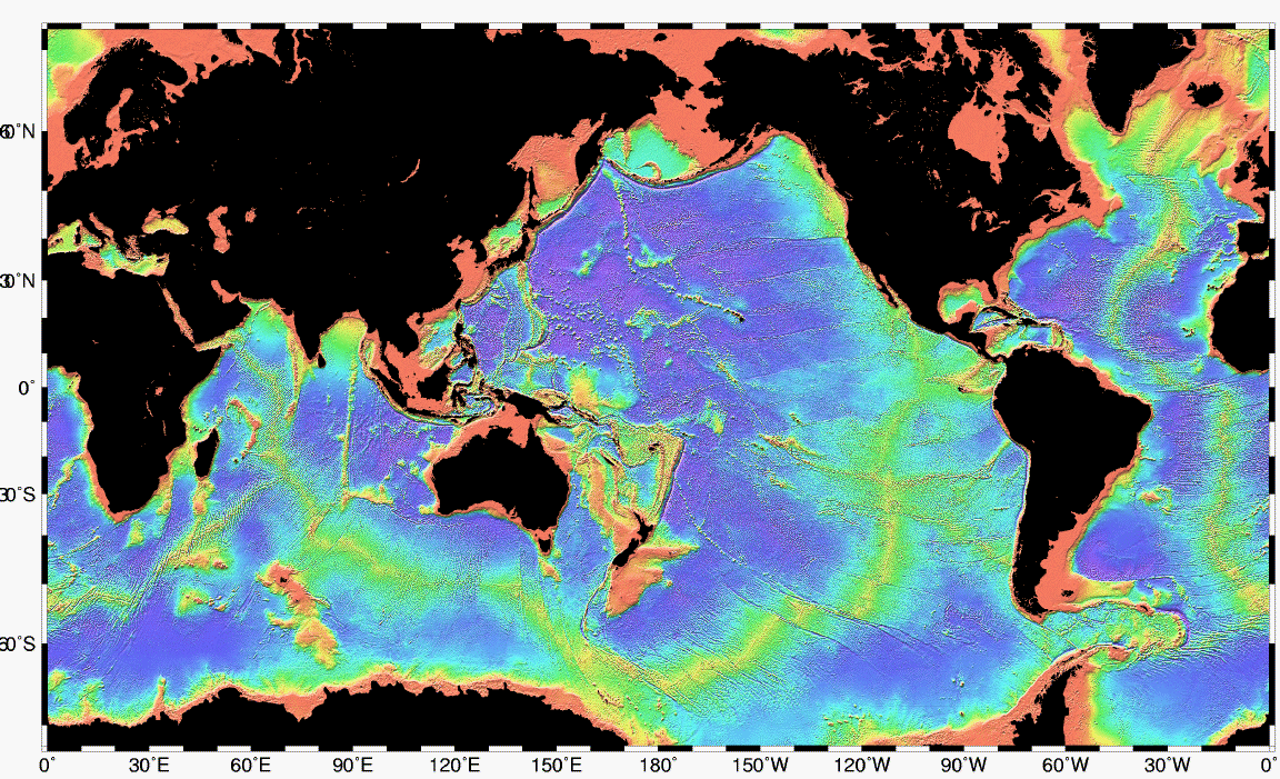
Approximately three-fifths of the planet’s surface lies beneath our vast oceans, including Earth’s longest mountain range and the land bridges early humans used to travel from one continent to another.

Recently, planetary scientist James O’Donoghue remade a 2008 NASA video to show what could be revealed if all ocean water drained.

From the Japanese space agency, JAXA, where he works, O’Donoghue, a former NASA scientist, took the video created by NASA physicist and animator Horace Mitchell and tweaked the timing. He also added a tracker to show the amount of water draining in animation.

As the water drains, you can see the underwater edges of the continents first. These are known as the continental shelves.

O’Donoghue told Business Insider,

“I slowed down the start since, rather surprisingly, there’s a lot of undersea landscape instantly revealed in the first tens of meters.”

The continental shelves also make up some of the land bridges humans used to cross to other continents. Our ancestors, from tens of thousands of years ago, were able to traverse from Europe to the U.K., and Siberia to Alaska, by land.

Early inhabitants of Australia could even walk to what are now islands surrounding the Australian continent.

O’Donoghue explained that water frozen at the poles during the last ice age melted and created the continents we know today while enclosing the humans where they were.

Earth’s longest chain of mountains, called the mid-ocean ridge, appears once the sea levels drop 2,000 to 3,000 meters, revealing its 37,000 global stretch. More than 90 percent of the range is underwater.

Volcanic mountains can be seen between the Earth’s tectonic plates. Most of the planet is revealed at 6,000 meters, with the Marianas Trench needing another 5,000 meters before totally emptying.

The video really does showcase how interesting the topography of the Earth is underneath the oceans and the chapters of our earliest existence.

What do you think about this revealing video? Let us know in the comments!

The post NASA Animation Shows Oceans Draining and What’s Beneath the Sea appeared first on UberFacts.

NASA Animation Shows Oceans Draining and What’s Beneath the Sea

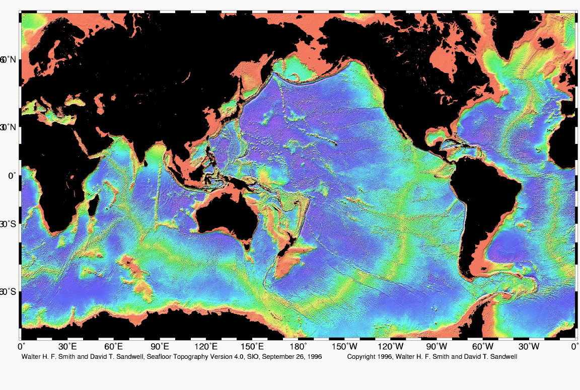
Approximately three-fifths of the planet’s surface lies beneath our vast oceans, including Earth’s longest mountain range and the land bridges early humans used to travel from one continent to another.

Recently, planetary scientist James O’Donoghue remade a 2008 NASA video to show what could be revealed if all ocean water drained.

From the Japanese space agency, JAXA, where he works, O’Donoghue, a former NASA scientist, took the video created by NASA physicist and animator Horace Mitchell and tweaked the timing. He also added a tracker to show the amount of water draining in animation.

As the water drains, you can see the underwater edges of the continents first. These are known as the continental shelves.

O’Donoghue told Business Insider,

“I slowed down the start since, rather surprisingly, there’s a lot of undersea landscape instantly revealed in the first tens of meters.”

The continental shelves also make up some of the land bridges humans used to cross to other continents. Our ancestors, from tens of thousands of years ago, were able to traverse from Europe to the U.K., and Siberia to Alaska, by land.

Early inhabitants of Australia could even walk to what are now islands surrounding the Australian continent.

O’Donoghue explained that water frozen at the poles during the last ice age melted and created the continents we know today while enclosing the humans where they were.

Earth’s longest chain of mountains, called the mid-ocean ridge, appears once the sea levels drop 2,000 to 3,000 meters, revealing its 37,000 global stretch. More than 90 percent of the range is underwater.

Volcanic mountains can be seen between the Earth’s tectonic plates. Most of the planet is revealed at 6,000 meters, with the Marianas Trench needing another 5,000 meters before totally emptying.

The video really does showcase how interesting the topography of the Earth is underneath the oceans and the chapters of our earliest existence.

What do you think about this revealing video? Let us know in the comments!

The post NASA Animation Shows Oceans Draining and What’s Beneath the Sea appeared first on UberFacts.

In 1981 Dean Koontz wrote a book…

In 1981 Dean Koontz wrote a book “The Eyes of Darkness”. The chapter 39 it mentions a Chinese military lab outside of the city of Wuhan, where a deadly virus is invented as part of the country’s biological weapons warfare programme. Owing to the lab’s location, the virus is named ‘Wuhan-400’.